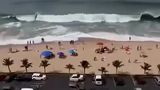
Hurricane Barbara is drawing attention along Mexico’s Pacific coastline, where residents are being urged to stay alert for possible heavy rain, strong winds, coastal flooding, and dangerous ocean conditions. Communities in Jalisco, Colima, Michoacán, and Nayarit may face different risks depending on the storm’s movement and intensity.
Heavy rainfall can create serious problems, especially in low-lying areas and regions where rivers may rise quickly. Flooding can disrupt roads, homes, and essential services, while mountainous areas may also face an increased risk of landslides. Residents are being encouraged to avoid flooded streets and stay away from unstable slopes.
Coastal conditions may also become dangerous as strong winds and changing ocean conditions produce rough seas and powerful waves. Storm surge can raise water levels along the shoreline, potentially affecting beaches, ports, and low-lying communities. Officials advise residents and visitors to respect warnings and avoid unnecessary trips near the ocean.
As the weather system develops, residents should follow updated forecasts and instructions from official meteorological and civil protection authorities. Preparing emergency supplies, reviewing evacuation plans, and checking on vulnerable family members can help reduce risks. The storm’s exact impacts may change, so reliable information remains essential.
The communities mentioned in the report are spread along a substantial section of Mexico’s Pacific coast. Their exposure can vary even while the same storm is nearby. On the coast, winds and waves can disrupt activity along beaches and in ports. Inland, rainfall can be the main issue, particularly around rivers, steep slopes and roads that cross low ground.
A storm’s center is only one point on a forecast map. Rain and waves can reach communities that the center never crosses. That is why a report about a coastal storm can name several states at once while local notices give different instructions for particular towns or stretches of shoreline. The track helps explain where the storm is expected to move. The local notices help explain what that movement means for people in a specific place.
The source gives particular attention to flooding. Water can collect in low-lying streets and make an ordinary route difficult to use. On higher ground, the concern may shift to slopes that have taken in heavy rain. A road can connect both kinds of terrain in a short distance, which is one reason the condition of a route matters as much as the weather visible from a home or hotel.
The effect on the ocean is another part of the report. Large waves and rough water can be a concern even when the strongest winds are offshore. Beaches, harbors and other places that sit close to the water may therefore have different restrictions from surrounding streets. Officials can adjust those instructions as the forecast changes and as they learn more about conditions on the ground.
The timing of the report matters because the article describes preparations ahead of possible impacts. It names the conditions authorities were watching and the areas where people were asked to stay alert. The extent of the disruption would depend on how Barbara moved and where the heaviest rain, wind and waves developed. That is the distinction between the possibilities described in the forecast and the conditions communities would later experience.